
Leveraging data analytics and a model-based methodology for traffic pattern prediction ensures the strategic positioning of stations and seamless integration with various transportation modes.
By Prathamesh Gawde, Senior Product Marketing Manager at Bentley Systems
Reducing Carbon through Public Transportation
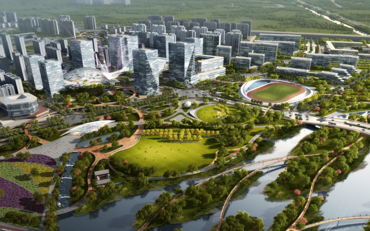
Strong public transportation options are a must for thriving cities – they improve the quality of life for residents while greatly lessening the need for carbon-emitting private vehicles and reducing other atmospheric pollutants that directly impact public health. But in the recent past, the northeast part of Chaoyang District, Beijing did not have sufficient public transportation options despite few people owning cars, leaving resident travel needs unmet. To address the problem, the Beijing Municipal Institute of City Planning & Design, in partnership with five other institutes, began developing multiple rail lines and two subway stations for the district. In the process, the organization wants to promote an overall transformation and rebirth of the project area, as well as encourage various modes of green transportation, including the use of bicycles.
Seeking Optimal Rail Placement
The design team knew that the new transportation system had to be intelligently designed. Incorrectly placing the tracks and stations could discourage their use, causing frustrated travelers to continue to rely on carbon-intensive and more polluting forms of transportation. They also needed to create a plan that encouraged the use of bicycles and other green modes of transportation. To meet all project goals, the team needed to ensure the project would be utilized by analyzing and connecting various modes of travel to and from the rail system, as well as forecasting travel demand.
READ ALSO
Analyzing Traffic for Informed Design
The team determined they could calculate the demand for rail transit and predict traffic flow with different traffic modes by using CUBE. Within the application, they determined the total travel volume, distribution, and mode of transportation to, from, and within the district, along with the transportation connection needs between stations. Based on that analysis, the design team determined how to build the rail transit micro-center demonstration area, as well as how to schedule shared bicycles, mini-buses, shared cars, and other rail transit connection modes. After the initial analysis, the team uses CUBE for additional, automated analyses that consider land use and population changes, helping to fine-tune connecting transportation as needed.
Intelligent Design Reduces Pollutants
By basing the design and layout of the rail lines and station on predicted demand, the design team created a smart travel system that can reach the entire area within 10 minutes, improving travel efficiency by 15%. Encouraging the use of the rail lines, as well as planning and providing connections to lower and zero-carbon-emitting and polluting modes of transportation to final destinations, will significantly reduce the use of carbon-emitting and less polluting vehicles while easing navigation through the city and improving health. The rail system also incorporates energy storage facilities to balance power supply and demand, further improving energy efficiency.
According to Tong Sheng, Smart City Planner, Beijing Municipal Institute of City Planning & Design,
“By using CUBE software to analyze the traffic flow, the project provided a strong basis for the planning and construction of transportation infrastructure and the arrangement of public transportation capacity for the rail micro-centers. The system provides scientific data prediction and judgment for the construction of the rail transit micro-center demonstration area, scheduling shared bicycles, mini-buses, shared cars, and other rail transit connection modes.”
Facts:
- The rail design can reach the entire area within 10 minutes, improving travel efficiency by 15%.
- Encouraging the use of the rail lines, as well as providing connections to lower-carbon transportation modes and encouraging the use of bicycles, will significantly reduce the use of carbon-emitting vehicles and atmospheric pollutants while easing navigation through the city.
- The rail system also incorporates energy storage facilities to balance power supply and demand, further improving energy efficiency.